Canyonlands National Park has many must-do national park hikes, from dramatic canyon overlooks to challenging desert hikes. Known for its intricately carved canyon, hiking above and into Canyonlands belongs on any Utah road trip itinerary.
This guide covers the 12 best hikes in Canyonlands National Park. From easy to challenging hikes, this post will help you build an epic hiking itinerary and prepare for your trip to Canyonlands National Park.
I’m sharing the best things to do in Canyonlands National Park, plus tips on precisely what you need to know before your trip and where to stay near the trailheads.
Read to discover the best trails in Canyonlands? Let’s dive in!
This post may contain affiliate links, where I may receive a small commission at no additional cost to you. Read more in this disclosure policy.
Arches & Canyonlands At-A-Glance
Before diving in, here are a few highlights to help you plan your trip:
- Best Time to Visit: Spring or Fall are the best times to visit thanks to mild weather, perfect for hiking. Avoid crowds by visiting in March or November, on either end of peak season (just be sure to bundle up as it will be chilly!).
- Where to Stay: The only way to stay in either park is by camping – neither park have lodges. The best place to stay near both parks is in Moab, Utah. I highly recommend the Red Cliffs Lodge or Best Western Plus Canyonlands Inn.
- How to Get There: The closest airport is in Salt Lake City, about 4 hours away. Use Expedia to browse flights and find the best price.
- How to Get Around: The easiest way to get around both Arches and Canyonlands is in your own car. Use Expedia to browse deals on rental cars or rent an RV or campervan with Outdoorsy.
- Best Self-Guided Tour: My favorite way to learn more about the park is with GyPSy Guides, a narrated self-guided tour perfect for road trips and scenic drives. The Arches & Canyonlands Guide and the Utah “Mighty 5” Bundle both provide incredible commentary and detail about the history and geology of these parks.
- Don’t Forget: Be sure to get an America the Beautiful National Park Pass ahead of time. This $80 pass is valid for 12 months and get you into all 400+ national park sites (including Arches and Canyonlands!).
Overview of Canyonlands National Park Hikes Districts
Canyonlands National Park protects over 300,000 acres of land in southeastern Utah. From desert landscapes to deeply carved canyons to photogenic arches, Canyonlands has plenty to see.
This large national park is split into four original regions: Island in the Sky, The Needles, The Maze, and Colorado and Green Rivers District. A fifth region nearby, Horseshoe Canyon, was added in 1971.
Island in the Sky is the most visited part of Canyonlands National Park. About 1 hour southwest of Moab, Utah, it is the most easily accessible region in Canyonlands.
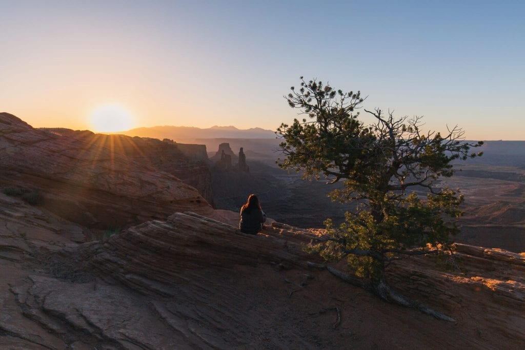
The Island in the Sky district is known for its scenic drive, grand canyon overlooks, and easy hikes to must-see spots like Mesa Arch.
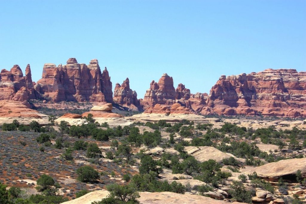
The Needles district gets its name from striped, colorful spires found here. More remote than Island in the Sky, The Needles is known for its strenuous day hikes and multi-day backpacking trips through colorful desert landscapes.
The Maze is one of the most off-the-beaten-path areas in Canyonlands National Park. This remote desert region is home to rugged desert terrain, making it difficult to navigate. However, experienced hikers and backpackers can find plenty of solitude in this area.
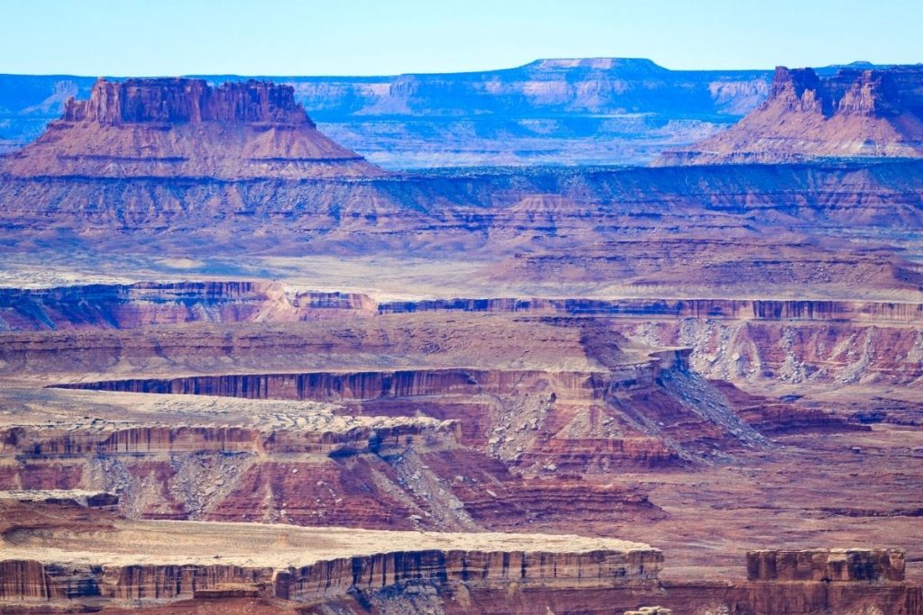
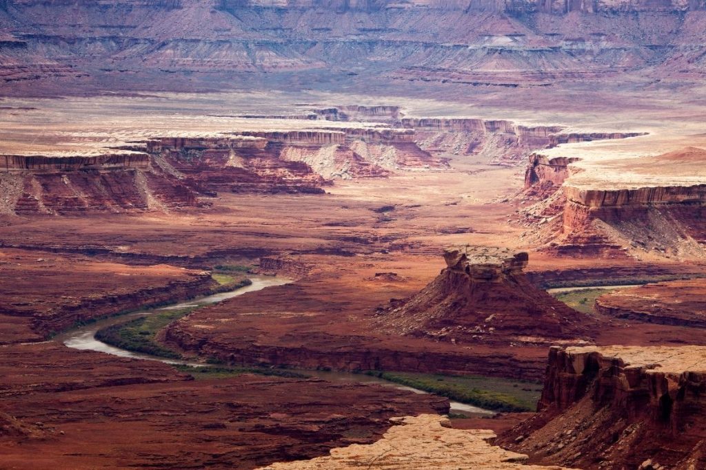
Canyonlands National Park was carved by two rivers: the Colorado and Green Rivers. This park region cuts through the canyon’s center, filled with lush greenery in stark contrast to the surrounding desert landscapes. The Rivers District is a popular spot for water sports like kayaking, canoeing, and rafting.
The Horseshoe Canyon district is home to the Great Gallery, a historic panel filled with impressive indigenous rock art. This region is unattached to the rest of Canyonlands National Park, separated by the Glen Canyon Recreation Area.
Most of the hikes in this guide are found in the two most accessible districts in Canyonlands National Park: Island in the Sky and The Needles.
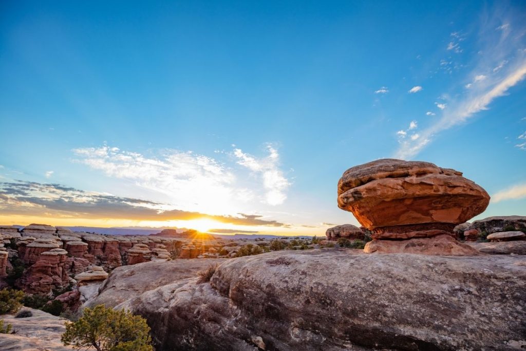
Tips for the Best Hiking in Canyonlands National Park
- Start your hike early. Parking lots for popular trailheads like Grand View Point and Mesa Arch will fill up in the middle of the day. To find parking more quickly and avoid hiking in the hottest part of the day, I recommend arriving shortly after sunrise to start your hike. Early morning is also the best lighting over the canyon!
- Visit in Spring or Fall. The shoulder months are the best time to visit Canyonlands National Park. Temperatures are milder, perfect for exploring the best hikes in the park.
- Pack plenty of water. Even on colder days, it’s important to pack plenty of water for your hikes. The dry climate and moderate elevation will cause you to dehydrate faster than you usually would. So be sure to pack at least 0.5 liters of water per person per hour of hiking.
- Don’t forget the ten essentials! Hiking in parts of Canyonlands National Park is arid, remote, and harsh. Stay prepared and safe by packing the ten hiking essentials for your trip.
- Dress in layers. Temperatures are often below freezing overnight, even in Spring and Fall. As the sun rises, the day heats up. I recommend dressing in several layers, such as breathable long-sleeved tops, a fleece jacket, and a down jacket.
- Get the America the Beautiful National Park Pass. If you’re visiting several national parks on your Utah trip, you can save money by buying a national park pass ahead of time! The America the Beautiful pass is only $80, valid for 12 months, and gets you into 63 national parks! If you don’t opt for the national park pass, you’ll need to pay the $30 entrance fee to enter the park.
Are you visiting multiple national parks in the next year? The America the Beautiful National Park Pass gets you into 400+ national park sites, including all 63 national parks, for 12 months!
Get your national park pass ahead of time for only $80.
Where to Stay Near Canyonlands Best Hikes
There are no lodges in Canyonlands National Park. The only way to stay in the park is at one of the park’s two campgrounds.
- Willow Flat Campground in Island in the Sky is a first-come, first-served campground with 12 sites.
- The Needles Campground in The Needles district has 29 sites and accepts reservations from Spring through Fall.
In addition, there are campgrounds in parks surrounding Canyonlands, including Kayenta Campground in Dead Horse Point State Park and Horsethief Campground in the Bureau of Land Management area.
Moab is the best place to stay near Canyonlands if you aren’t interested in camping, especially if you also plan on visiting Arches National Park. This small town is located just under an hour from the Island in the Sky district and offers plenty of hotels, motels, and Airbnbs.
This interactive map can help you search all the available hotels and rental properties near Arches & Canyonlands National Parks! Simply scroll and click the map below to see what is available!
My favorite hotels in Moab near Canyonlands National Park are:
- Red Cliffs Lodge, a peaceful hotel along the Colorado River in Moab
- Hoodoo Moab, a more luxurious hotel in downtown Moab
- Best Western Plus Canyonlands Inn, a budget-friendly hotel in downtown Moab
Read More: 22 Places to Stay Near Arches & Canyonlands
Best Easy Hike Options in Canyonlands National Park
The Island in the Sky district is filled with easy, must-do hikes to stunning canyon overlook and rock formations. Popular trails like Mesa Arch and Grand View Point belong on every Canyonlands National Park itinerary.
These short, family-friendly trails are manageable for most hikers, even those with limited experience.
Mesa Arch
- District: Island in the Sky
- Distance: 0.7 miles
- Elevation: 88 feet
- Average Time to Hike: 30 minutes
- Read more on AllTrails
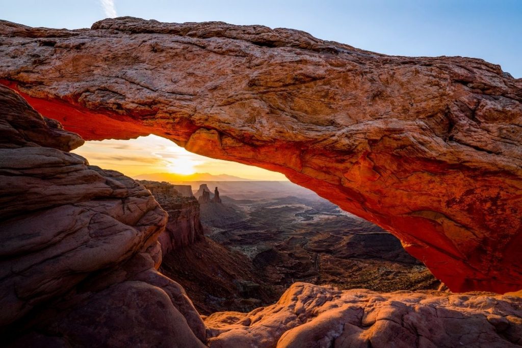
Mesa Arch is one of the most iconic trails in Canyonlands National Park. This short hike is one of the best sunrise spots in Canyonlands and is incredibly popular among tourists and photographers.
The easy loop starts off Grand View Point Road at the Mesa Arch Trailhead. Then, you’ll follow a dirt and slickrock trail out to the final viewpoint at Mesa Arch.
The arch forms a window overlooking Buck Canyon and the distant La Sal Mountains.
Read More: Ultimate Mesa Arch Sunrise Guide
White Rim Overlook
- District: Island in the Sky
- Distance: 1.8 miles
- Elevation: 160 feet
- Average Time to Hike: 1.5 hour
- Read more on AllTrails
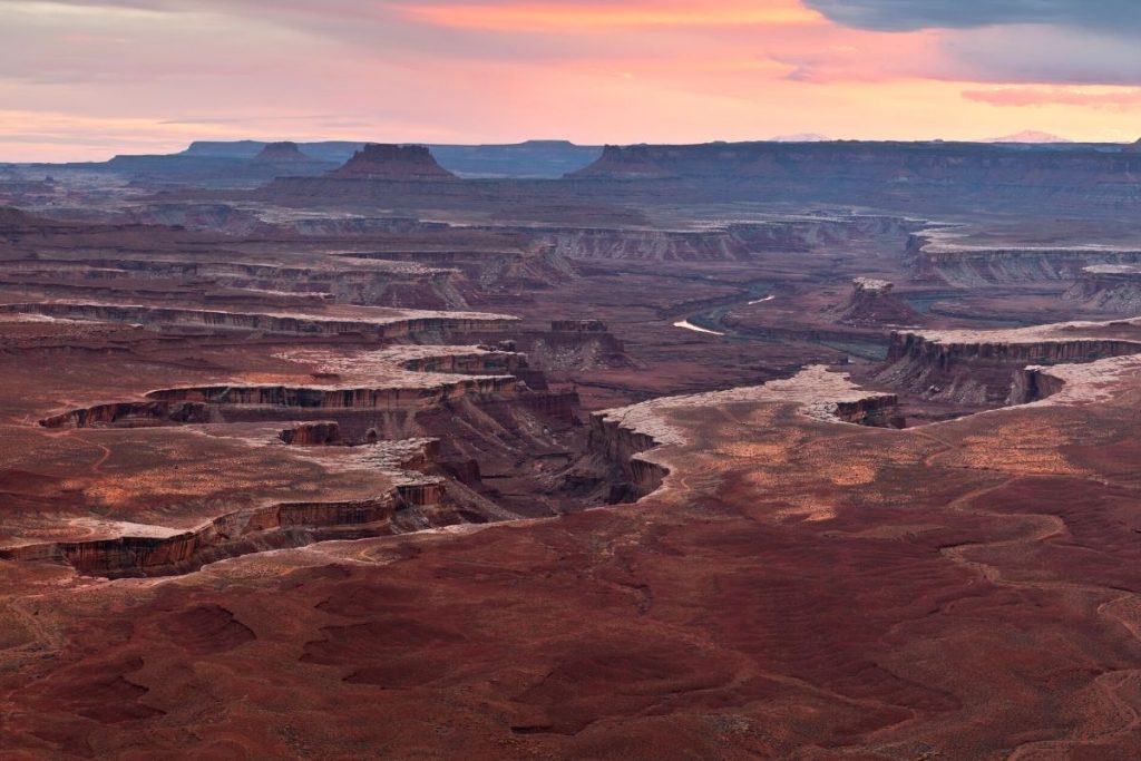
The trail to White Rim Overlook takes you out along the top of the canyon for stunning views of the Colorado River, Monument Basin, the La Sal Mountains, and the iconic White Rim Road, a multi-day scenic drive along the canyon floor.
You’ll start your hike to White Rim Overlook at the Gooseberry Trailhead. Since the final viewpoint faces east, this trail is best in the late afternoon when the sun is behind you, illuminating the canyon.
Looking for more epic viewpoints of the canyon? Don’t miss Shafer Canyon Overlook or Green River Overlook!
Grand View Point Trail
- District: Island in the Sky
- Distance: 1.8 miles
- Elevation: 160 feet
- Average Time to Hike: 1 hour
- Read more on AllTrails
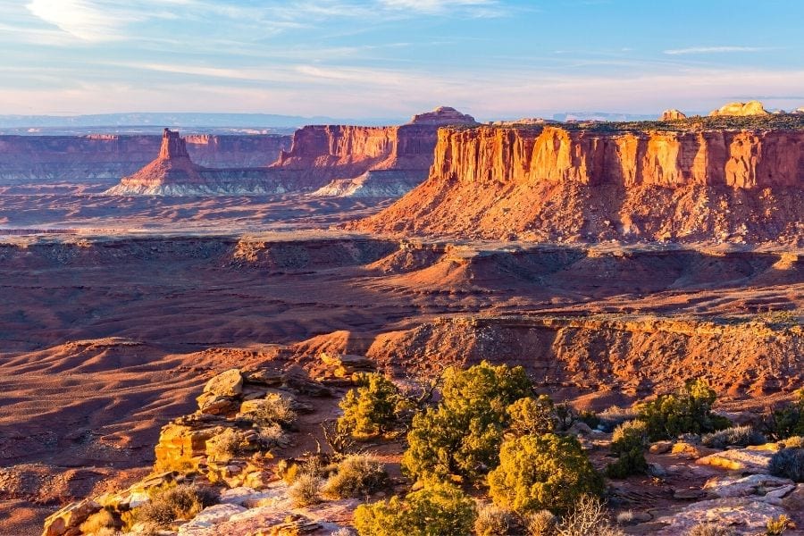
The Grand View Point Trail is one of the best easy hikes in Canyonlands National Park. The trail follows the top of the canyon with plenty of panoramic views.
In the canyon below, you can spot both the Colorado and Green Rivers that carved Canyonlands.
Grand View Point Overlook marks the start of the trail out atop the canyon. Many visitors choose to stop at the overlook, but I highly recommend doing the entire 2-mile hike for amazing views.
Murphy Point Trail
- District: Island in the Sky
- Distance: 3.4 miles
- Elevation: 147 feet
- Average Time to Hike: 1.5 hours
- Read more on AllTrails
Murphy Trail is one of the long easy trails in Canyonlands National Park. This hike follows the top of the mesa, with good views of Candlestick Tower, the Green River at the bottom of the canyon, and the iconic White Rim Road.
For the best views, hike the trail to Murphy Point just before sunset. Then, as the sun fades, the panoramic landscape views come to life and glow in the golden light.
Whale Rock Trail
- District: Island in the Sky
- Distance: 0.8 miles
- Elevation: 131 feet
- Average Time to Hike: 30 minutes
- Read more on AllTrails
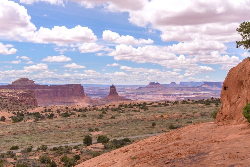
For a short hike to a stunning viewpoint, look no further than the Whale Rock Trail. The walk begins at the Upheaval Dome trailhead.
Then, you’ll climb from the parking lot to the top of Whale Rock, a large, unique rock formation overlooking the nearby Upheaval Dome crater.
From the final viewpoint, you have great views of the Island in the Sky District of Canyonlands National Park and the Colorado and Green Rivers below.
Don’t miss the best of Utah’s national parks on your upcoming trip! This free, printable Utah national park road trip itinerary covers all the best points of interest in all 5 Utah parks, plus bonus tips on where to stay and side trips to nearby state parks and monuments.
Download your free Utah road trip itinerary here.
Best Moderate Canyonlands Trails
For more of a challenge, opt for a slightly more challenging, moderate hike while in Canyonlands National Park.
These intermediate trails are the perfect way to escape the crowds found at the more popular overlooks and accessible walks in the Island in the Sky district.
Upheaval Dome Overlook
- District: Island in the Sky
- Distance: 1.3 miles
- Elevation: 226 feet
- Average Time to Hike: 45 minutes
- Read more on AllTrails
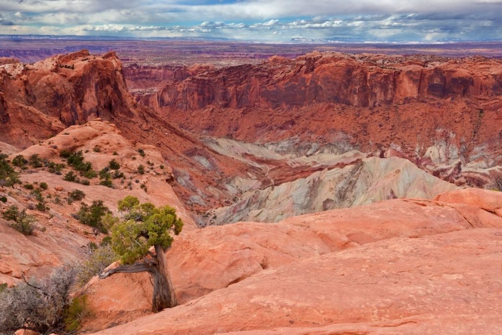
Upheaval Dome is the most popular hike of the moderate ones on this list. Its moderate rating comes not from a distance but from the elevation gain. The trail is just over a mile long but climbs more than 200 feet, a roughly 7% grade.
The viewpoint overlooks Upheaval Dome, a massive crater rumored to have been formed by an ancient meteorite. After this hike, add the nearby Whale Rock Trail or the longer, strenuous Syncline Loop for a full-day adventure.
Aztec Butte Trail
- District: Island in the Sky
- Distance: 1.7 miles
- Elevation: 259 feet
- Average Time to Hike: 1 hour
- Read more on AllTrails
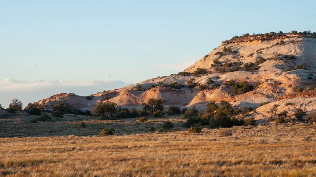
Aztec Butte is one of the more challenging moderate hikes in Canyonlands. The trail follows a sandy path (which makes hiking difficult) to a junction.
One fork goes to panoramic views from Aztec Butte, and one split goes to a smaller butte with ancestral Puebloan food storage structures.
This trail requires more scrambling than other hikes in the park, so it’s essential to be prepared and only take on the hike if you’re up for the challenge.
Strenuous Hikes Canyonlands National Park
There’s a handful of strenuous day hikes found in Canyonlands National Park. The majority of Canyonlands’ strenuous hikes require a multi-day backpacking trip.
For a difficult, single-day adventure through Canyonlands, don’t miss these hikes in the Island in the Sky, The Needles, and Horseshoe Canyon districts.
Syncline Loop
- District: Island in the Sky
- Distance: 8.6 miles
- Elevation: 1,630 feet
- Average Time to Hike: 5 hours
- Read more on AllTrails
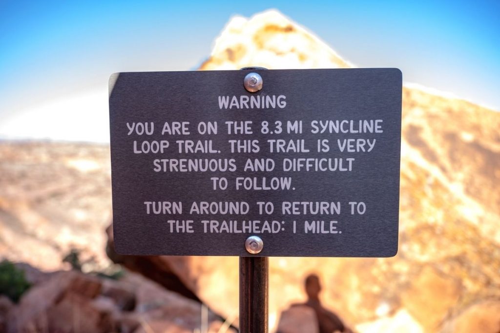
The Syncline Loop is one of the most challenging trails in the Island in the Sky region. This challenging hike follows the path around Upheaval Dome. You’ll traverse plenty of steep switchbacks, scrambled boulder fields, and climb more than 1,500 feet.
But, if you’re looking for solitude in Canyonlands, you’ll find few crowds on rugged trails like the Syncline Loop.
This trail is hot, dry, and long. Most saves by the National Park Service occur on this trail. Be prepared with plenty of extra water (~1L per person per hour) and the ten hiking essentials.
Confluence Overlook
- District: The Needles
- Distance: 10.0 miles
- Elevation: 1,371 feet
- Average Time to Hike: 5 hours
- Read more on AllTrails
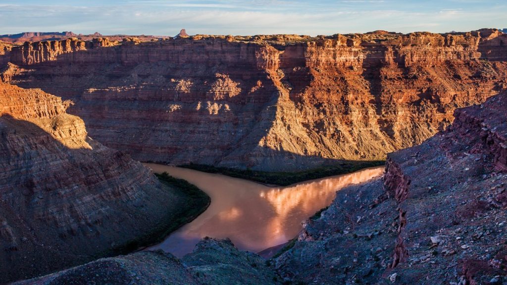
The Confluence Overlook gets its name from the final overlook: the Confluence of the Green and Colorado Rivers. This viewpoint overlooks the merging of the two large rivers that formed Canyonlands National Park and The Needles.
You’ll start at the Big Spring Canyon Trailhead and follow the northern edge of the geologic fault that shaped The Needles before reaching the final, impressive viewpoint.
Chesler Park Loop / Joint Trail
- District: The Needles
- Distance: 10.4 miles
- Elevation: 1,820 feet
- Average Time to Hike: 6 hours
- Read more on AllTrails
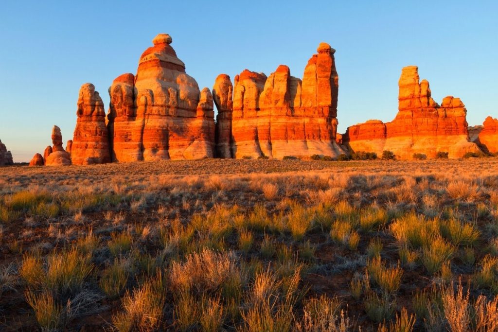
Don’t miss the Chesler Park/Joint Trail for a challenging hike with panoramic views of The Needles district! The trail starts at the Elephant Hill Trailhead and meanders through slickrock and a narrow slot canyon.
You’ll then merge with the Joint Trail, full of adventurous opportunities for rock scrambling.
To reach the trailhead, you’ll need an AWD vehicle as the road is not paved. If you’re interested in breaking this hike up over two days, you can camp (advance permit required) at the Chesler Park Campground.
Druid Arch Trail
- District: The Needles
- Distance: 10.4 miles
- Elevation: 1,614 feet
- Average Time to Hike: 5.5 hours
- Read more on AllTrails
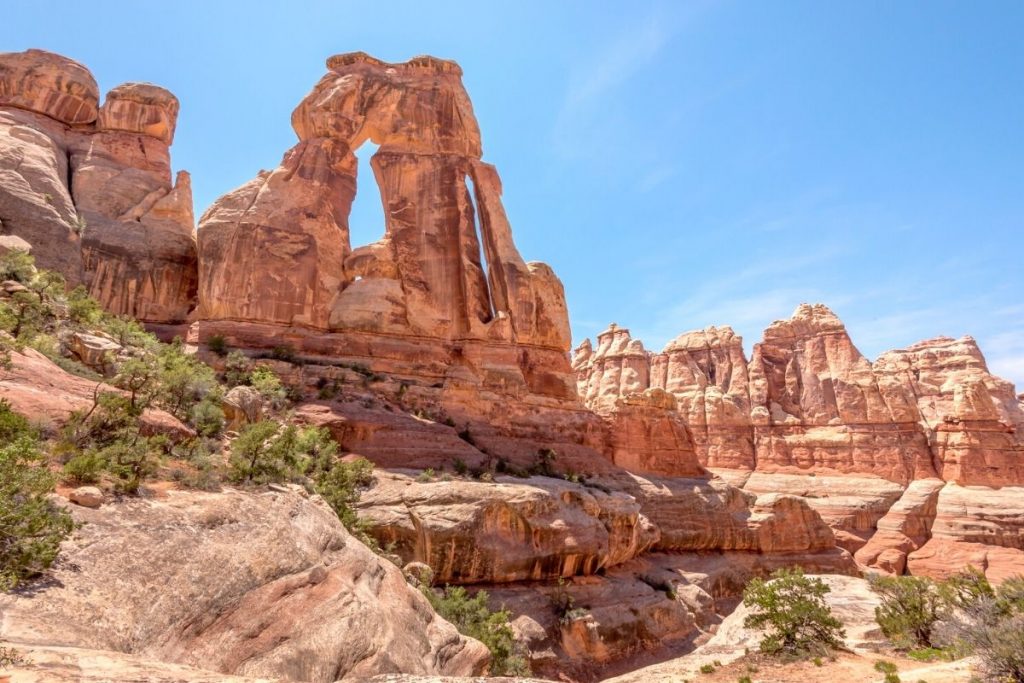
The Druid Arch Trail also starts at the Elephant Hill Trailhead (and requires AWD to reach). You’ll find some of the most spectacular views of The Needles District along this trail.
The trail starts along the same path at the Chesler Park Trail but splits off to head to the bottom of Elephant Canyon.
You’ll traverse deep sand, loose rock that requires scrambling, and a ladder along this trail. The final stretch to Druid Arch is steep and incredibly challenging, but you’re rewarded with unique rock formations and views.
The Druid Arch Trail isn’t for the faint of heart but provides one of the best adventure hike opportunities in Canyonlands.
Great Gallery in Horseshoe Canyon
- District: Horseshoe Canyon
- Distance: 10.6 miles
- Elevation: 1,646 feet
- Average Time to Hike: 5.5 hours
- Read more on AllTrails
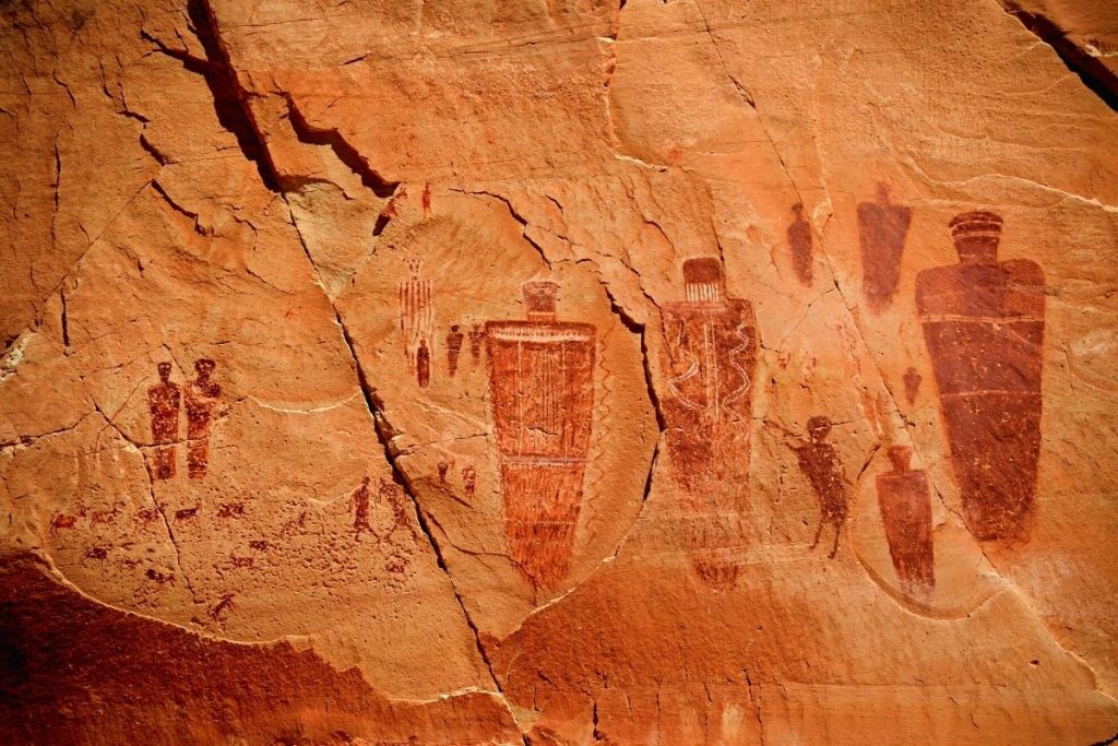
The Great Gallery trail is located in a smaller, separate area of Canyonlands National Park called Horseshoe Canyon.
To reach the trailhead, you’ll need to access Horseshoe Canyon from Highway 24 (AWD is recommended). This area is 2.5 hours from the Island in the Sky District and much closer to Capitol Reef National Park.
Don’t miss the Great Gallery trail if you’re looking for a strenuous and memorable trail when driving from Capitol Reef National Park to Moab!
The hike follows a difficult, sandy trail out to well-preserved rock art. You’ll find life-sized ancient paintings and impressive sandstone cliffs.
Read More: 15 Best Things to Do in Capitol Reef
Frequently Asked Questions on the Best Hike in Canyonlands
Which section of Canyonlands is best?
The Island in the Sky District is the most visited section of Canyonlands National Park. This area has plenty of accessible hikes, a beautiful scenic drive, and incredible panoramic viewpoints of the canyon.
How long should you spend in Canyonlands National Park?
To see the highlights of Canyonlands National Park, you need at least one day. A full day allows you to explore the most popular hikes in the Island in the Sky District, as well as the scenic drive and viewpoints. With more time, you can explore other districts, like The Needles and The Maze.
How many hikes are in Canyonlands?
There are over 75 hikes in Canyonlands National Park, ranging from easy to strenuous. You’ll find many of the more accessible, easy trails in the Island in the Sky District. However, trails found in The Needles and The Maze tend to be longer, multi-day backpacking trips.
Are there slot canyons in Canyonlands?
While there aren’t many slot canyons in Canyonlands National Park due to the rock formations found here, you can find a slot canyon along the Chesler Park Loop / Joint Trail in The Needles District.
Final Thoughts on Canyonlands National Park Best Hikes
Canyonlands is filled with beautiful hikes ranging in difficulty from easy, short walks to strenuous day hikes. So if you’re looking for inspiration for planning an epic trip to Canyonlands National Park, don’t miss these trails.
These are the 12 best hikes in Canyonlands National Park:
- Mesa Arch Trail
- White Rim Overlook
- Grand View Point
- Murphy Point
- Whale Rock
- Upheaval Dome Overlook
- Aztec Butte
- Syncline Loop
- Confluence Overlook
- Chesler Park Loop
- Druid Arch
- Great Gallery
Looking for more ideas for your trip to Canyonlands and Arches? Don’t miss these posts!
- Sunrise Spot: Ultimate Mesa Arch Sunrise Guide
- Where to Stay: 22 Places to Stay Near Arches & Canyonlands
- Road Trip: 8-Day Utah National Parks Itinerary
- All Utah Parks: 14 Best National Parks in Utah
Don’t miss the best of Utah’s national parks on your upcoming trip! This free, printable Utah national park road trip itinerary covers all the best points of interest in all 5 Utah parks, plus bonus tips on where to stay and side trips to nearby state parks and monuments.
Download your free Utah road trip itinerary here.
Don’t Forget to Save This Post on Pinterest ⤵︎
