Today, we carry our smartphones everywhere, including on the hiking trails! Your iPhone is way more than just a phone. It’s a compass, flashlight, camera, and GPS.
I know you’re probably thinking, “Isn’t the whole point of hiking to escape technology?”. Yes, in theory, but will you actually leave your phone at home?
Instead, consider downloading these 17 best hiking apps to enhance your hiking experience!
Best Hiking Apps At-A-Glance
- Best Free Hiking App: AllTrails
- Best GPS App for Hiking: Gaia GPS
- Best App for Mountain Identification: PeakVisor
- Best Hiking App You Already Have: Google Maps
- Best Backpacking App: FarOut (formerly Guthook Guides)
- Best App for Hiking Trails Inspiration: Hiking Project
- Best App for National Park Permits: Recreation.Gov
- Best National Park Hiking App: National Park Service App
- Best Nature Identification App: Seek by iNaturalist
- Best App for Stargazing Hikers: Skyview Lite
- Best Hiking Safety App: Cairn
- Best Hiking App for Apple Watch: Apple Fitness
- Best Hiking App for International Trails: Komoot
- Best Hiking Weather App: Weather Live
- Best Multi-Purpose Hiking App: Outdooractive
- Best Hiking App for Offline Maps: Avenza Maps
- Best AR Hiking App: Spyglass
Why Do You Need Hiking Apps
There’s a seemingly endless number of hiking apps out there, from navigation to inspiration! So, what can a hiking app do for you? Well, it turns out quite a lot.
- Inspiration – An app is a great way to discover hikes in your area and across the globe! You can save hikes you’re interested in, avoiding the Saturday morning Google search of “best hikes near me”.
- Navigation – An app can also help you find your trailhead and stay on course. Navigation is essential if hiking in an area with limited cell service.
- Learn – A smartphone is a walking encyclopedia, ready to help you learn about anything. There are hiking apps to teach you about plants, wildlife, and constellations.
- Performance Tracking – Not only can you use an app to track a hike for later, but you can also share hike performance. I love a good competition, so tracking hikes with friends and family is excellent motivation.
What to Look for in a Hiking App
Before diving into the roundup of the best hiking apps, it’s essential to consider what features are most important to you. The best app for you will depend on your preferences and the type of hiker you are.
Here’s what to keep in mind as you go about selecting a hiking app from this guide:
- Ability to Function Offline: Most hiking trails do not have cell service. It’s critical that any app you select, particularly one for navigation, is available offline to be used without cell phone service or wifi.
- Frequent Updates or User-Generated Information: Trail conditions are constantly changing. Regular updates to the app’s data or reviews from recent hikers help you stay up-to-date on conditions and closures.
- Detailed Trail Data and Maps: The more information, the better. Detailed trail data, including topographic maps, elevation profiles, and distance markers, can help you plan and conquer your hike.
- GPS and Navigational Tools: A good hiking app isn’t just a digital map; it’s a navigational tool. GPS tracking keeps you on the right path, even without a cell signal.
- Paid Features: Some apps offer advanced features at a premium. Assess whether these features, like downloadable maps and real-time weather, are worth the investment for your hiking style.
- Phone Battery Usage: An app is no good if it drains your phone’s battery too quickly. While this may be hard to evaluate before downloading the app, consider the availability of offline features. Using features offline is the best way to conserve phone battery when hiking.
- Data Privacy: Privacy on the internet is an ever-increasing topic of concern. As you venture into the wild, your data should remain yours. Consider the app’s privacy policy and how it handles your location and tracking information.
Remember, the best app suits your specific needs, whether planning a short day hike or embarking on a week-long trek. Keep these features in mind as we explore the top hiking apps that can enhance your next outdoor adventure.
Side-by-Side Comparison of the Best Hiking Apps
| App | Use | Free Version? | Paid Version? | Available Offline? |
|---|---|---|---|---|
| AllTrails | Trail Discovery | Yes | Yes, $35.99/year | Yes (Paid version only) |
| Gaia GPS | Trail Navigation | Yes | Yes, $39.99/year | Yes |
| PeakVisor | Mountain Identification | Yes | Yes, $89.99 | Yes (Paid version only) |
| Google Maps | Navigation to Trailhead | Yes | No | Yes |
| FarOut | Backpacking | Yes | Yes, $5.99-$74.99 per guide | Yes |
| Hiking Project | Trail Discovery | Yes | No | Yes |
| Recreation.Gov | National Park Permits | Yes | No | No |
| National Park Service App | National Park Hikes | Yes | No | Yes |
| Seek by iNaturalist | Wildlife Identification | Yes | No | No |
| Skyview Lite | Stargazing | Yes | Yes, $1.99 | Yes |
| Cairn | Route Sharing & Safety | Yes | Yes, $26.99/year | Yes (Paid version only) |
| Apple Fitness | Fitness Tracking | Yes | Yes, $79.99/year | Yes |
| Komoot | Trail Discovery | Yes | Yes, $59.99/year | Yes |
| Weather Live | Weather Forecasts | Yes | Yes, $19.99/year | No |
| Outdooractive | Trail Discovery + Cycling | Yes | Yes, $29.99/year | Yes (Paid version only) |
| Avenza Maps | Trail Navigation | Yes | Yes, $32.99/year | Yes |
| Spyglass | Augmented Reality | No | Yes, $5.99 | Yes |
Are you planning a hike but aren’t sure what to pack? Get this free, printable hiking gear checklist. This guide covers the 30+ items you need for your next hike, from the 10 hiking essentials to the luxury items to enjoy your adventure.
Download the free hiking gear checklist here.
1. AllTrails: Best Free Hiking App
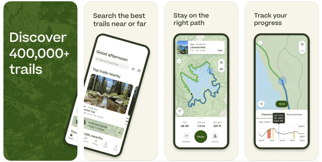
AllTrails is one of the most well-known hiking apps out there. With over 20 million users and 100,000 trails worldwide, it’s easy to see why. AllTrails is my go-to hike planning app.
Hikes are searchable based on difficulty, length, elevation gain, route type, and user rating. You can also search hikes based on tags, like trail running, dog-friendly, or wildflowers.
Once you find a hike, you can view specific details, like distance and an elevation profile map. All Trails also provides tips and information on getting to the trailhead, how long the hike should take, and user reviews.
All Trails also allows users to record their hikes, tracking the route using GPS and time to complete.
While the base version of All Trails is free, they also offer a paid version for $29.99 per year. AllTrails+ lets you download maps offline and sends notifications if you stray off-trail. The Plus version also comes with 3D maps!
- Available on: iOS & Android
- Price: Free & Paid Versions ($35.99/year)
- Differentiators: Extensive trail database, Reviews from real users, Intuitive interface
- Cons: Some features require a Pro subscription
- Paid Features: Offline maps, Off-route notifications, 3D maps
2. Gaia GPS: Best GPS App for Hiking
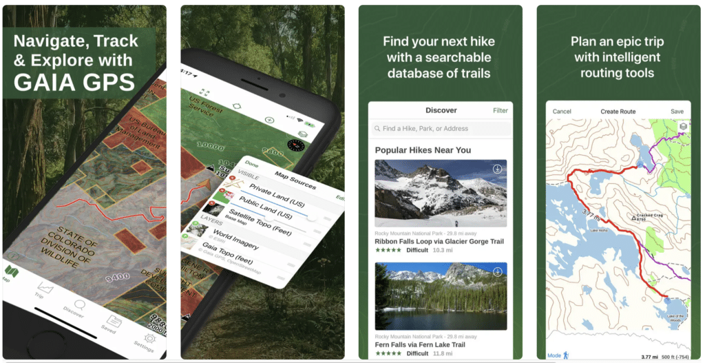
Gaia GPS is one of the most popular hiking apps for navigation. In this app, you can find new trails, record your route, and save hike statistics and performance. The app will even tell you the weather forecast and help you find camping near your hike!
There is a free and paid version of the Gaia GPS hiking app. For most day hikers, the free version is enough. In the free version, you can view topographic and satellite maps and track your hike with cell service.
For backpackers or advanced hikers, I recommend the paid version. For only $39.99 per year, Gaia GPS Premium unlocks offline maps, including backpacking, off-road driving, backcountry skiing, and mountain biking trails.
The offline map feature is crucial for navigating and staying on trail without cell service.
- Available on: iOS & Android
- Price: Free & Paid Versions ($39.99/year)
- Differentiators: Advanced GPS features, Comprehensive map layers, Designed for serious hikers
- Cons: Full functionality requires a subscription
- Paid Features: Offline maps, Premium map layers, Private land data
3. PeakVisor: Best App for Mountain Identification
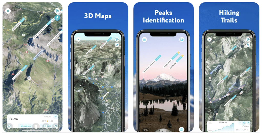
Have you ever looked off in the distance and said, “What mountain is that?”. If so, I’ve got good news for you! It’s an app called PeakVisor.
Here’s how it works: you open the app on your phone, point it at the peak, and it will tell you, using a combination of image recognition and GPS location.
You can even upload pictures of mountains from past hikes or when you’re without service, and the app will identify those, too! The catalog of mountain peaks is over 1 million.
This app also offers a compass, which is excellent for hiking navigation.
PeakVisor comes in both a free and pro version. The free version allows you to use most of the app’s features. The Lifetime Pro version’s most significant advantage is offline peak identification and 3D maps – no cell service is required!
- Available on: iOS & Android
- Price: Free & Pro Versions ($89.99 one-time payment)
- Differentiators: 3D mountain panoramas, Advanced peak identification technology
- Cons: Peak identification can be inconsistent in remote areas
- Paid Features: Offline use, Detailed 3D maps
4. Google Maps: Best Hiking App You Already Have
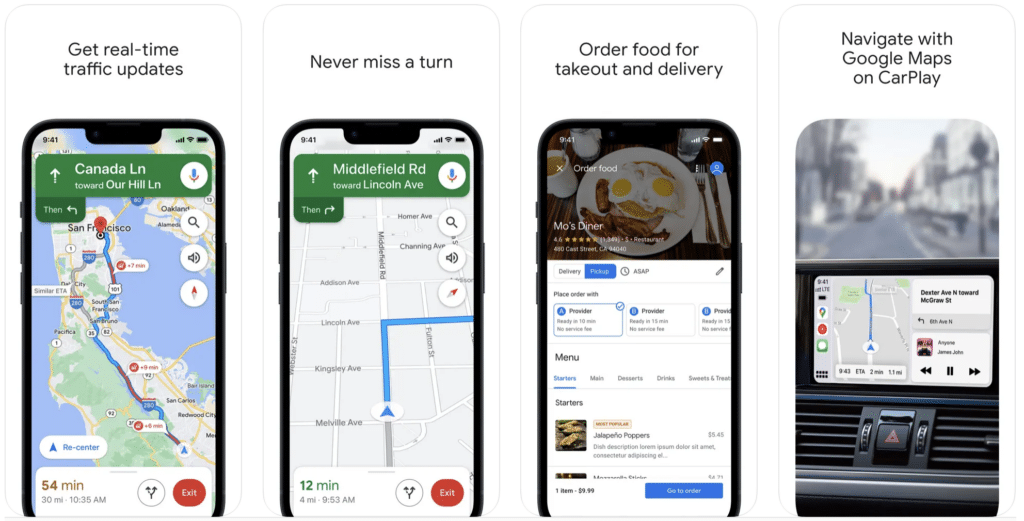
There’s a very high likelihood you’re already using this app. But I’d be willing to bet you’re not using it to its full functionality. The best feature of Google Maps for hikers is downloading maps offline.
Downloading maps ahead of time will ensure you can navigate to the trailhead even if you lose service.
Since GPS continues to work without cell phone service, you can use Google Maps to navigate with your downloaded map.
Many popular trails in busy parks are also shown on Google Maps, allowing you to track your progress on the trail and stay on track.
In the app, you can download a customized region. I recommend downloading the area from your home to your trailhead and the entire trail area.
To download offline in Google Maps, go to the app, select Offline Maps from the menu, select a custom map to highlight the area, and click download.
- Available on: iOS & Android
- Price: Free
- Differentiators: Reliable for trailhead navigation, Offline functionality
- Cons: Not reliable for trail or backcountry navigation
5. FarOut (Formerly Guthook Guides): Best Backpacking App
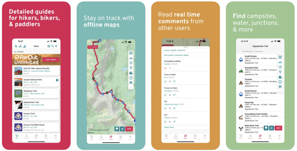
FarOut is the most popular smartphone app for long-distance hiking and backpacking. With over 35,000 miles of trails in its database, it’s a go-to for thru-hikes like the Pacific Crest Trail or the Appalachian Trail.
It was developed by former thru-hikers who understood the need for a reliable offline map. In the app, you’ll find detailed trail information like distance, elevation, waypoints, water sources, and campsites, all viewable on topographic or satellite maps.
The app tracks your location on the map, ensuring you’re always on the trail. All of this works offline without cell reception.
The app itself is free, but each trail is purchased individually. You can buy complete trail guides for thru-hikes or smaller trail guides for national parks. The guides range from $4.99 to $59.99, depending on trail length.
The app offers some free demo trails to get you started, too.
- Available on: iOS & Android
- Price: Free, but requires in-app purchases of the guides ($5.99-$74.99 per guide)
- Differentiators: In-depth trail guides, Offline maps, Designed for backcountry hikes
- Cons: Each trail guide must be purchased separately
- Paid Features: In-app purchases for specific trail guides
6. Hiking Project: Best App for Finding New Hiking Trails
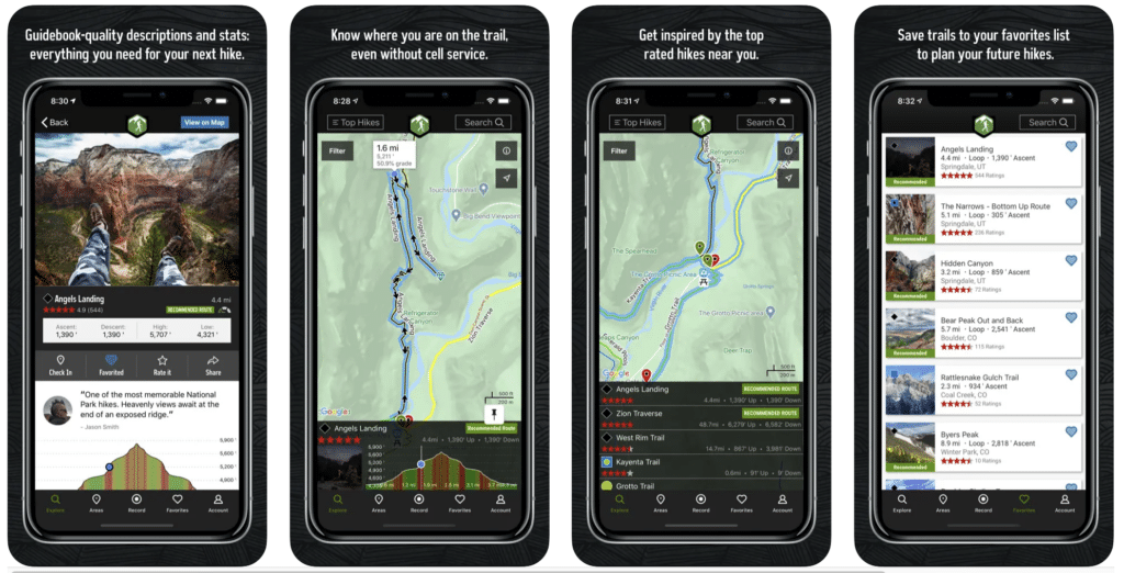
This crowd-sourced hiking app is also great for inspiration. While much of the functionality is similar to AllTrails, Hiking Project provides points of interest (labeled “Gems” in the app).
You can search for hikes by region, point of interest, or hike features. With hikes mainly in the US and Canada, the Hiking Project lets you see stats by state, including trails ranked by popularity.
For a specific hike, you can view detailed trail descriptions, wildlife and plants in the area, user reviews, and trail conditions. The Hiking Project app gives you a feel for the hike before stepping on the trail.
- Available on: iOS & Android
- Price: Free
- Differentiators: Reviews from real users, Detailed trail descriptions
- Cons: Limited international trails, Relies on the community for updates
7. Recreation.Gov: Best App for National Park Permits
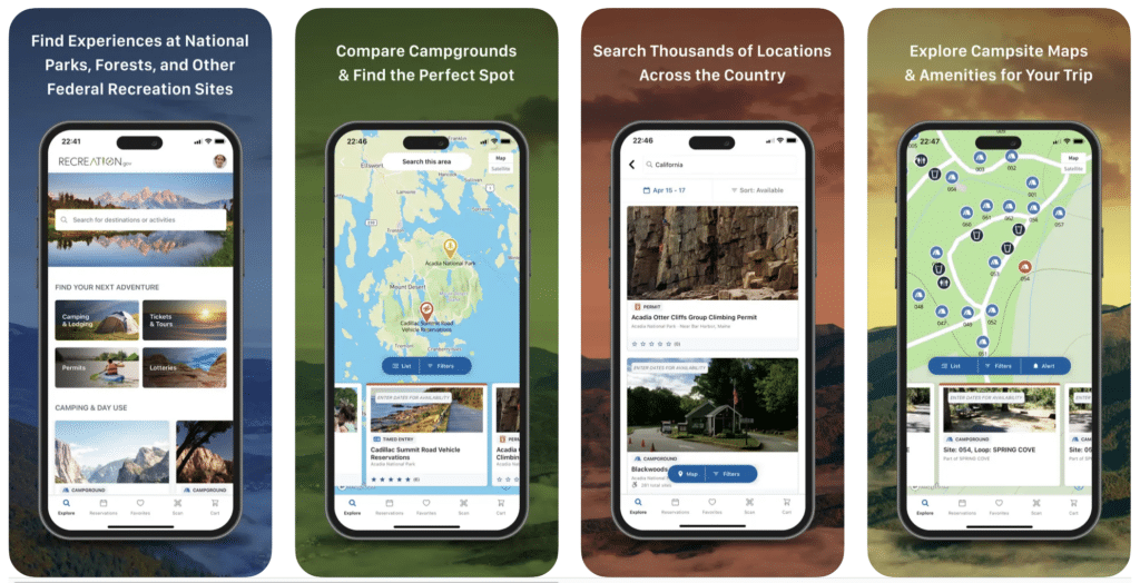
If you’re an avid national park camper, you’re probably already familiar with this app. But Recreation.Gov can be used for a lot more than booking campsites. This app is also a platform to book tours, tickets, and permits.
Many US national parks offer ticketed ranger-led tours, like Fiery Furnace in Arches National Park, bookable through the app.
Permits to wilderness areas, like Mt. Whitney or the Lost Coast in California, are booked through this app, too.
Recreation.Gov is the official place to enter lotteries for permits to places like The Wave in Arizona or Half Dome in Yosemite.
You can also buy interagency passes, like the America the Beautiful National Park Pass, through the Recreation.Gov app.
The moral of the story is that Recreation.Gov is one of the best hiking apps for government lands. Most sites open six months in advance if you’re trying to book permits or campgrounds.
- Available on: iOS & Android
- Price: Free
- Differentiators: Official resource for permits, camping reservations, and lotteries for national park sites
- Cons: Not a dedicated hiking app, No offline functionality
8. National Park Service App: Best App for National Park Hikes
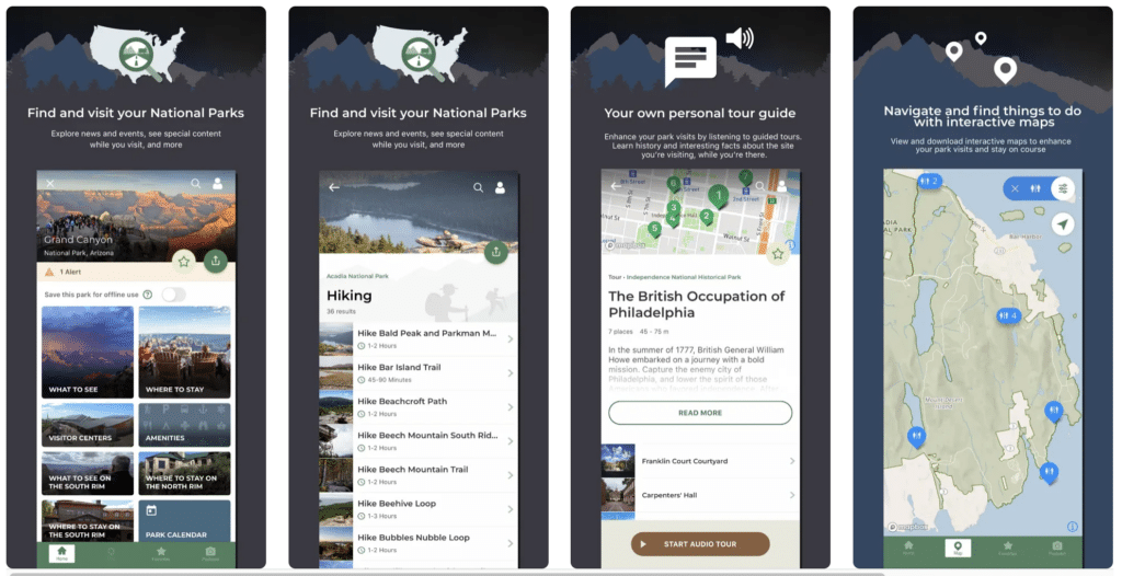
For national park lovers, the National Park Service app is a must! This app has everything you need to know about all 423 national park units, including the 63 US national parks.
You’ll find information on the best things to do (including lots of hikes), where to stay, tours, park amenities, and more.
What park do you want to visit? You can explore the various national parks, create favorites lists, and mark parks as visited.
The app also details each park’s most popular hikes, including the distance and time to complete the hike. You’ll also find directions to trailheads and maps available offline without cell service.
- Available on: iOS & Android
- Price: Free
- Differentiators: Comprehensive guide to national parks, Official NPS information
- Cons: Not a dedicated hiking app
9. Seek by iNaturalist: Best App for Nature Lovers
Have you ever seen a plant on the trail and wondered, “What kind of plant is that?”. I used to do this all the time, and I’d think, wow, wouldn’t it be cool if an app could tell you these things?
Well, it turns out there is!
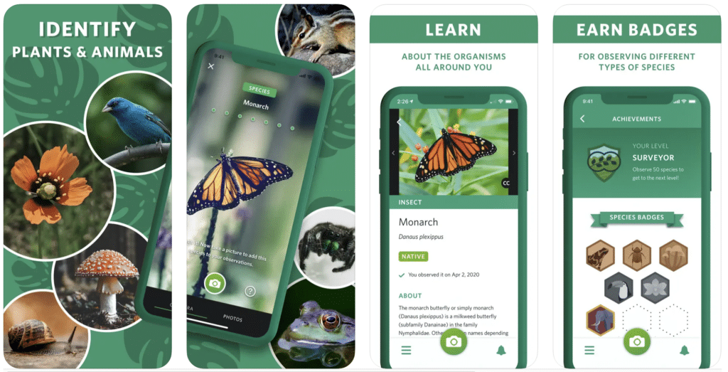
One of the most remarkable hiking apps is Seek by iNaturalist. It was developed by the California Academy of Sciences and National Geographic. Seek uses your camera and GPS location to identify plants and animals you encounter on the trail.
To use it, simply take a photo of your subject using the app. Seek uses your location to narrow down possible species and gives you more information about what you’ve found.
And because everything is more fun if it’s a game, you can earn badges and achievements based on the species you discover.
- Available on: iOS & Android
- Price: Free
- Differentiators: Engages users with nature, Educational and game-like
- Cons: Identification can be less accurate without the internet
10. Skyview Lite: Best App for Stargazing
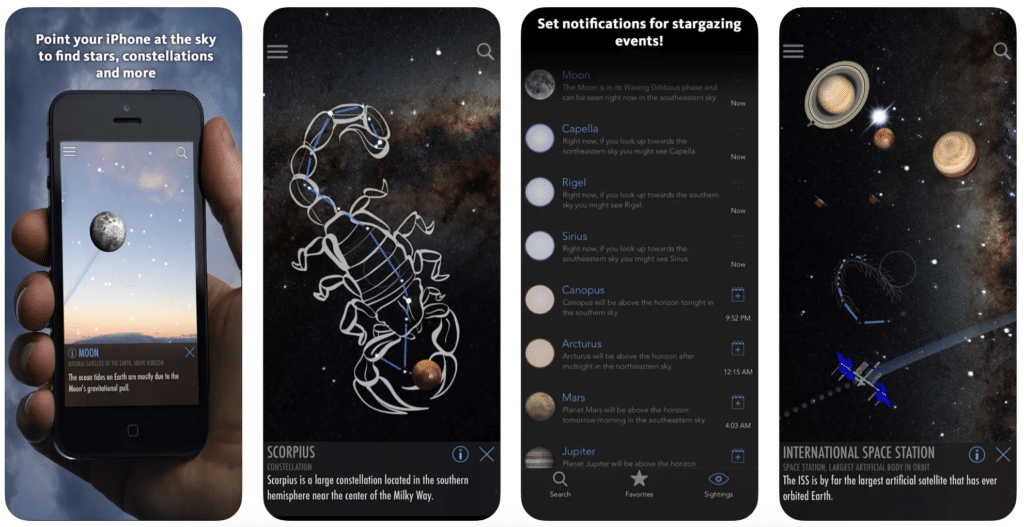
This free hiking app is the only tool you need to identify planets, stars, and constellations in the night sky. The app uses the phone’s built-in compass to locate astronomical objects.
The app overlays graphics of night sky objects based on where you point your phone. Plus, you can read more about the object of interest, such as the International Space Station.
You can even set notifications for upcoming stargazing events, like meteor showers or planet sightings. I’ve found this app to be great for stargazing before sunrise or after sunset.
The free “lite” version is excellent for most hikers. Still, the full, paid version of the app offers an Apple Watch app, a widget for your phone, and thousands of additional night sky objects!
- Available on: iOS & Android
- Price: Free & Paid Versions ($2.99 one-time purchase)
- Differentiators: Easy identification of stars and constellations, Notifications for celestial events
- Cons: Lite version has limited features
- Paid Features: Apple Watch app, Additional night sky objects, No ads
11. Cairn: Best Hiking Safety App
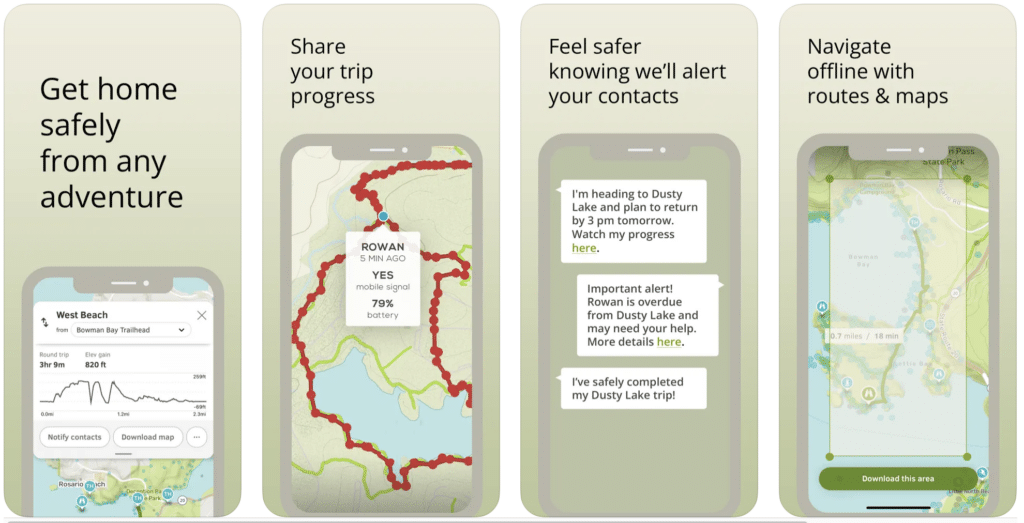
Cairn is the ultimate hiking safety app! All the app’s features are designed to keep you safe on the hiking trail.
The most popular features include sharing your route and GPS location with friends and family, downloading offline maps, and real-time location and status updates.
The app tracks your estimated time to complete the hike from your location and helps you track your progress with offline trail maps.
You’ll also find information on where other hikers have found cell service along the hike. You’ll be notified when you enter an area with cell service.
The free version of the app lets you use the basic features, like maps, trails, and cell coverage when you have cell service.
The paid version allows you to use the app entirely offline, including offline maps and live progress updates to your emergency contacts.
All users can get a 30-day free trial of the paid version before purchasing.
Cairn is available for Android or iPhone with a 60-day free trial.
- Available on: iOS & Android
- Price: Free & Paid Versions ($26.99/year)
- Differentiators: Safety features, Location sharing, Cell service finder
- Cons: Some features require a premium subscription
- Paid Features: Offline maps, Live tracking, Safety notifications
12. Apple Fitness: Best Fitness Tracker for Hikes
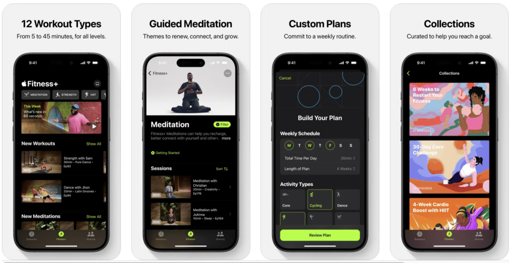
Apple Fitness is the best hiking app for your Apple Watch! Wearing a fitness tracker is an easy way to keep track of the distance you’ve covered on the trail.
I recommend investing in an Apple Watch if you use other Apple products.
The app logs your time, active calories, heart rate, distance, and elevation with its custom ‘Hiking’ workout. After your hike, you can see a summary of the exercise and a GPS map of your route with mile times.
It’s one of the best ways to track your progress as you train for longer, more challenging hikes.
- Available on: iOS
- Price: Free & Paid Versions (Fitness+ is $79.99/year). While the free version works with an iPhone, you’ll get the most value by having an Apple Watch to track fitness.
- Differentiators: Integrated with the Apple ecosystem, Designed exclusively for fitness tracking
- Cons: Requires an Apple Watch for best functionality, Limited to iOS
13. Komoot: Best Hiking App for International Trails
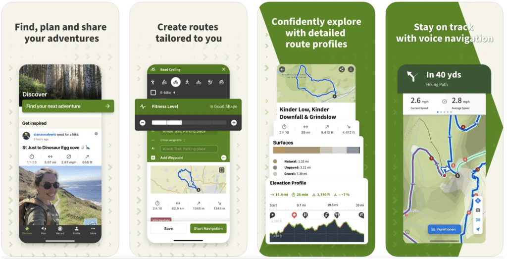
Komoot is more than just a hiking app. It’s a route planner, a guide, and a vast repository of international trails at your fingertips. Perfect for beginners and seasoned adventurers, it allows users to design and customize their hiking experience.
With detailed topographic maps, voice navigation, and the ability to download maps for offline use, Komoot is invaluable for international travel where data connection can be unreliable.
The app also syncs across devices, so you can plan on your computer and follow the trail on your phone.
- Available on: iOS & Android
- Price: Free & Paid Versions ($59.99/year)
- Differentiators: Detailed route planning, International trails, Syncs across devices
- Cons: Requires an in-app purchase for full map access
- Paid Features: Offline maps, Multi-day route planner, Voice navigation
14. Weather Live: Best Hiking Weather App
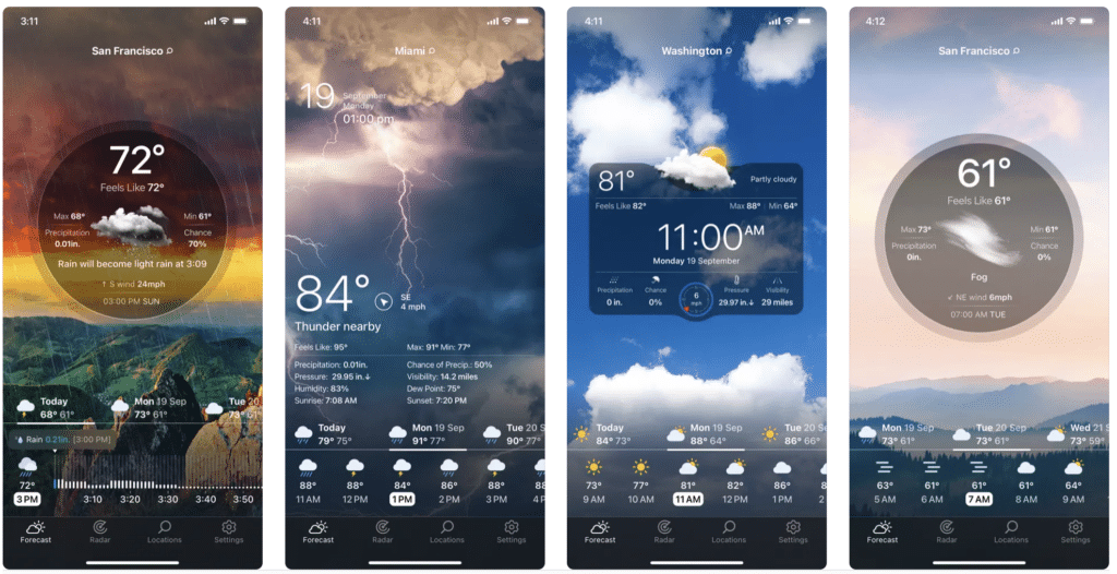
Weather Live is an essential app for hikers who want to stay updated on weather conditions. Its real-time forecasts can help you decide whether to embark on a hike or wait out a storm.
Its sleek interface lets you quickly access temperature, precipitation, wind speed, and severe weather alerts.
Though it requires a data connection to update, knowing the weather before you leave home can make all the difference in planning a safe and enjoyable hike.
- Available on: iOS & Android
- Price: Free & Paid Versions ($19.99/year)
- Differentiators: Real-time weather updates, Customizable layout, Weather alerts
- Cons: Requires a data connection for live updates
- Paid Features: Extended forecasts, Interactive weather maps, ad-free experience
15. Outdooractive: Best Multi-Purpose Hiking App
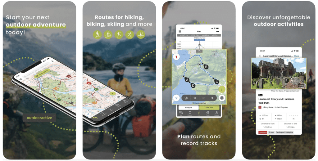
Outdooractive caters to outdoor enthusiasts of all types. It combines trail planning, community engagement, and detailed topographical maps in one user-friendly platform.
Users can discover new trails, create personal guides, and share their experiences with an active community. It’s an excellent app for cyclers, mountain bikers, and hikers!
For those looking to hike abroad, Outdooractive offers trails from various countries. With the pro version, you can access offline maps and other advanced features, ensuring you’re well-prepared for your next hike.
- Available on: iOS & Android
- Price: Free & Pro Versions ($29.99/year)
- Differentiators: Trail planning, Community features, International trails
- Cons: Some advanced features require a Pro subscription
- Paid Features: Offline maps, Pro Route planner, No ads
16. Avenza Maps: Best Offline Maps for Hiking
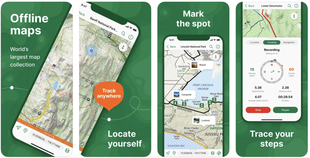
Avenza Maps is a robust map viewer that turns your smartphone into a GPS device. Hikers who love the detail of a paper map will appreciate the high-quality, georeferenced maps available through its store.
The app allows you to download maps designed for various outdoor activities. You can record your route, drop waypoints, and even measure distances.
Avenza is a powerful tool for those who navigate off the beaten path and value precision in their planning. With the Plus version, users can import their own maps and utilize advanced geofencing and mapping options.
- Available on: iOS & Android
- Price: Free & Paid Versions ($32.99/year)
- Differentiators: Access to a vast array of maps, Accurate GPS navigation, Offline functionality
- Cons: Detailed maps require an in-app purchase
- Paid Features: Additional map downloads, Advanced features like map editing
17. Spyglass: Best AR Hiking App
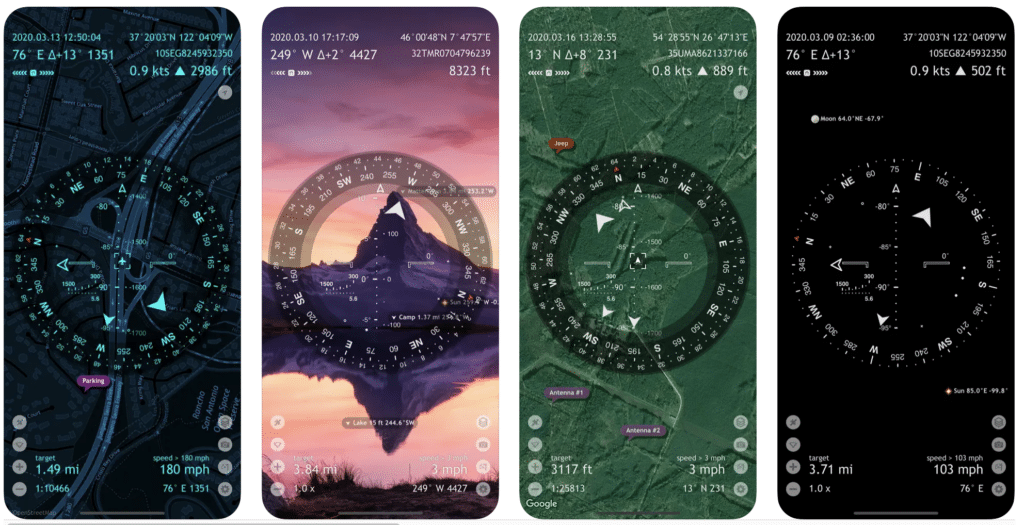
Spyglass is the perfect, innovative app for hikers who want to explore with the help of technology. This advanced compass and GPS app uses augmented reality to overlay the compass on a live camera view, showing your waypoints, stars, and maps.
Whether you’re navigating dense forests or desert dunes, Spyglass offers a suite of professional tools that can guide you back to camp or help you find the next landmark.
Its offline compass functionality lets you confidently venture into the wilderness, knowing you have a powerful navigation aid.
- Available on: iOS & Android
- Price: $5.99 (no free version)
- Differentiators: Advanced navigational toolkit, Augmented reality technology, Off-trail navigation
- Cons: Full suites of features require a one-time purchase
- Paid Features: Full functionality unlocked with a one-time purchase (no subscription)
Frequently Asked Questions About the Best Hiking App
What is the best free hiking app?
The best free hiking apps are:
- AllTrails
- Gaia GPS
- Hiking Project
- National Park Service App
- Seek by iNaturalist
What is the best hiking app for iPhone?
The best hiking apps for iPhone are:
- AllTrails
- Gaia GPS
- Apple Fitness
- Cairn
Is Google Maps good for hiking?
While it is excellent at helping you navigate to a trailhead, Google Maps is not good for hiking and trail navigation. The map layers in Google Maps don’t share detailed information on the trail conditions and topography, and many hikes aren’t found on Google Maps.
Does Google Maps show hiking trails?
Google Maps does show hiking trails. You’ll see dotted hiking trails on most views of the map. It is easy to track your progress on popular trails in busy parks. Google Maps isn’t always reliable for less popular trails, so I recommend AllTrails Pro or Gaia GPS for tracking in more remote places.
Can I use my phone GPS for hiking?
Yes! Using your phone GPS for hiking is a great way to track your progress and stay on the trail. Many hiking apps, like AllTrails and Gaia GPS, work on your smartphone using its GPS to show your location in real-time on topographic hiking maps.
What is the best GPS app for hiking?
The best GPS app for hiking is Gaia GPS. With slightly better maps and navigation than AllTrails, this is the best navigation app. To use the map and features offline, you’ll need to pay for a Gaia GPS subscription of $39.99 per year.
Is there a better app than AllTrails?
AllTrails is one of the most popular free hiking apps. However, serious hikers view Gaia GPS as better than the AllTrails app. Gaia GPS is more geared towards trail navigation for regular hikers, with premium features like offline trail maps, GPS navigation, and hike tracking.
Final Thoughts on the Best Hiking Apps
I hope I’ve convinced you by now that technology can enhance your hiking experience, not detract from it. But it never hurts to silence notifications to escape from the calls, texts, and emails for a little bit.
Looking for most hiking gear and tips? Check out these posts!
- What to Pack for Hiking in 2024
- Best Hiking Clothes for Women in 2024
- Best Hiking and Camping Gear on Amazon
- Ultimate Guide on Hiking for Beginners
Are you planning a hike but aren’t sure what to pack? Get this free, printable hiking gear checklist. This guide covers the 30+ items you need for your next hike, from the 10 hiking essentials to the luxury items to enjoy your adventure.
Download the free hiking gear checklist here.
Don’t Forget to Save This Post on Pinterest
