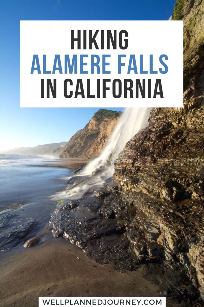
Alamere Falls is one of only 34 waterfalls in the world that flows into an ocean. And only 4 of those are in the United States! This 13-mile trail to stunning, and rare, 40-foot falls should be on your California bucket list.
A little over an hour from San Francisco, this is the perfect day trip to escape the city and see the beauty of the biggest Bay Area waterfall.
Ready to pack up your bag and start your Alamere Falls hike? Read on for all the important details on getting to the trailhead, the best route to the falls, and important tips to keep you safe on the trail!
Looking for more Northern California bucket list experiences? Check out these posts!
This post may contain affiliate links, where I may receive a small commission at no additional cost to you. Read more in this disclosure policy.
Best Time to Hike Alamere Falls
Thanks to the mild weather in the San Francisco Bay Area, the Alamere Falls trail is accessible all year long. Typically, September and October are the warmest months in the Bay Area.
You might find morning fog most of the year, but the fog is sure to burn off after you begin your hike!
To see the falls at their fullest, make the hike to Alamere Falls in the Winter or Spring after heavy rain.
Alamere Falls is an incredibly popular trail, so it is important to start your hike early, regardless of when you go. To beat the crowds, arrive at the trailhead before 8 am.
How to Get to Alamere Falls and Parking at the Palomarin Trailhead
Alamere Falls is accessible from three trailheads in Point Reyes National Seashore. I recommend starting and ending at the Palomarin Trailhead for the Alamere Falls hike. It’s the shortest and most popular route to the falls.
The Palomarin Trailhead is roughly 5 miles northwest of Bolinas, California. From Bolinas, you’ll follow Mesa Road to the trailhead parking area.
The last 1.2 miles of Mesa Road is unpaved and riddled with potholes. While an AWD vehicle is ideal, a low-clearance sedan can make the trip (slow and steady wins the race!).
If there was ever a time to be a morning person, this is it. About 1.5 hours from San Francisco, the Palomarin Trailhead gets crowded early.
There’s a small parking lot at the trailhead, but parking is also allowed on the western side of Mesa Road.
Arrive by 8 am to ensure a parking spot. On busy summer days, even arriving at 8 am may mean adding distance to your hike from your parking spot along Mesa Road.
Alamere Falls Hike Details
- Distance: 13.8 miles (8.3 miles with “shortcut”)
- Elevation Gain: 1,955 ft (990 ft with “shortcut”)
- Difficulty: Moderate
- Estimated Hike Time: 7 hours
- Trailhead: Palomarin Trailhead
- Trailhead Facilities: Pit toilets and trash and recycling bins
- Pets: No dogs allowed
Alamere Falls in Point Reyes National Seashore is an essential bucket list hike in California.
The most popular route to the falls starts at the Palomarin Trailhead, although you can also start at the Bear Valley or Five Brooks Trailheads.
The official route to Alamere Falls from the Palomarin Trailhead is 13.8 miles, taking you through Wildcat Campground.
Over the years, a “shortcut” trail has gotten popular, cutting off nearly half the distance. This shorter trail is not sanctioned by the park service and requires scrambling down a rocky ledge.
Overview of the Alamere Falls Hike
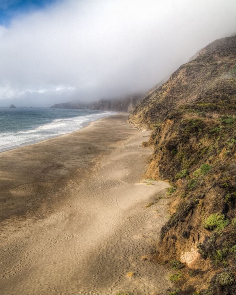
The 13.8-mile trail to Alamere Falls from the Palomarin Trailhead starts in a eucalyptus grove. When you emerge from the grove, you’ll be on a rolling, exposed dirt path along the coastline (seriously, the coastal views never get old!).
On a clear day, you can make out the Farallon Islands in the distance.
After a climb on the dirt path, you’ll reach a cool, shaded forest where the trail narrows. This area is home to many swampy ponds and 4 lakes. The most popular of these, Bass Lake, is a summer swimming destination.
Roughly 4 miles into your hike, you’ll reach the “shortcut” trail to Alamere Falls. To stay on the official trail, you should continue straight past this turn-off, following signs for Wildcat Campground.
After another half mile, you’ll reach a split in the trail. The right fork continues on the Coast Trail and the left fork takes you to the Ocean Lake Loop Trail.
Both trails reach Wildcat Campground, forming a loop around Wildcat Lake. After 1.4 miles on either trail, you’ll reach the campground. From here, Alamere Falls is only a 1-mile hike along the beach away.
Wildcat Campground to Alamere Falls
It’s extremely important that you check the tides before setting out along the beach. The incoming tide can trap you and potentially lead to injury or death.
For more on tide tables and staying safe on the coastal hike to Alamere Falls, read the “Tips on Hiking Alamere Falls” section below.
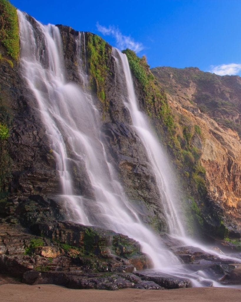
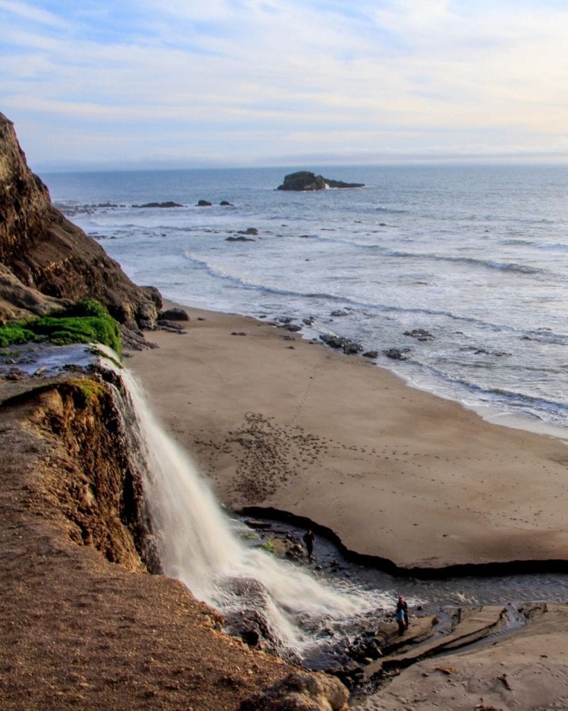
Alamere Falls is the largest of the Bay Area waterfalls, dropping 40 feet over the cliffside into the Pacific Ocean. At high tide, the waterfall flows directly into the ocean. At low tide, a small stream feeds into the waves.
Alternate Route: Alamere Falls Shortcut Hike
This trail was closed in 2014 after storm damage made the trail unsafe, but it’s still the most popular way to reach the falls. This trail breaks off from the official route about 4 miles from the Palomarin Trailhead.
An unmarked trail through thick, unmaintained brush cuts west to the top of Alamere Falls. This unmaintained trail is covered in poison oak and ticks, so be sure to wear long pants.
To get the same beach-level view as those coming from Wildcat Campground, you’ll need to scramble down a rocky cliff edge. This is dangerous and the reason the National Park Service does not condone this route.
Rangers have to make at least one emergency rescue per week due to hikers getting stuck or injured.
The cliff edges in this area are unstable. Rocks can crumble, causing you to fall, or loose gravel can fly off the cliff edge, hitting hikers below. The rocky scramble requires scooting and climbing to reach the bottom.
It should only be attempted by those in good physical shape and in hiking boots with proper traction. This part of the trail is only accessible by one hiker at a time, so you may need to wait to descend and return.
The “shortcut” trail saves you 5 miles and 1,000 feet of elevation gain but you hike at your own risk. The National Park Service is not liable for any injuries that occur when off the maintained trail.
Alamere Falls Trail Map and Elevation Profile
Maps are an ever-important part of planning a hike. Check out this trail map and elevation profile of the official Alamere Falls trail.
Point Reyes National Seashore has so much to offer, like the popular Tomales Point Trail at the other end of the park.
Along the trail to Alamere Falls from the Palomarin Trailhead, you can make stops at Bass Lake and Palomarin Beach.
Bass Lake is a popular summer swimming destination, but be warned, there’s no lifeguard on duty. Just under 3 miles from the Palomarin Trailhead, you’ll find a short side trail leading to the side of the lake.
Not far from the Palomarin Trailhead, the Coast Trail splits. One trail heads towards Alamere Falls and the other towards Palomarin Beach.
You can take the half-mile trail down to Palomarin Beach. This rocky beach provides great ocean views and opportunities to spot wildlife in tide pools.
Backpacking in Point Reyes National Seashore
Make a weekend out of your trip to Alamere Falls by backcountry camping at Wildcat Campground for a night. With only 8 campsites, Wildcat Campground is almost always booked, particularly on weekends.
If you’re planning to stay on a weekend, you should book 6 months out when reservations open on Recreation.Gov.
Even with a reservation, you’re required to pick up your permit at the Bear Valley Visitor Center on your arrival date. For this reason, I recommend starting your hike from the Bear Valley Trailhead instead of the Palomarin Trailhead.
Read More: The Ultimate Guide to Hiking for Beginners
Tips for Hiking Alamere Falls
Alamere Falls is the best waterfall near San Francisco. For that reason, it is incredibly popular. Here are a few helpful tips to avoid the crowds and stay safe on the trail:
- Arrive at Palomarin Trailhead early. Parking begins to fill up around 8 am, meaning you could be left adding a mile or two to your hike from your parking spot along Mesa Road.
- The official trail to Alamere Falls passes through Wildcat Campground. The “shortcut” trail is popular but unmaintained. If you choose the shorter route, hike at your own risk and only continue if you feel confident in your ability. Regardless of the trail you choose, always check trail status on the Point Reyes National Seashore website before setting out.
- Do not attempt the hike from Wildcat Campground to Alamere Falls during high tide or when the tide is coming in. At high tide, the water reaches the base of the bluffs, leaving you stranded with nowhere to stand. If waves are already reaching the base of the bluffs at Wildcat Beach, turn around. Always check the tide and surf conditions before attempting the hike. NOAA published tide tables on their website. Use these tide tables to help you time your hike based on up-to-date tide predictions.
- Download digital maps or carry a physical park map. Cell service is extremely limited in Point Reyes National Seashore. Download Google Maps for the region ahead of time (both to navigate to the trailhead and along the trail). I also recommend downloading the trail details using AllTrails Pro.
- Follow the Leave No Trace Principles. Stay on the trail this includes taking the official trail instead of the “shortcut”). Keep your distance from wildlife and respect other hikers. Want to learn more about the Leave No Trace Principles and trail etiquette? Read my guide on Hiking for Beginners.
Are you planning a hike but aren’t sure what to pack? Get this free, printable hiking gear checklist. This guide covers the 30+ items you need for your next hike, from the 10 hiking essentials to the luxury items to enjoy your adventure.
Download the free hiking gear checklist here.
What to Pack for the Alamere Falls Hike
Every hiker should be prepared, particularly on long hikes like the one to Alamere Falls. Before starting your hike, make sure you have all these hiking essentials packed:
- The Ten Essentials. This hike comes with more risk than others, particularly if you’re attempting the dangerous “shortcut” trail. Pack everything you’d need to perform field first aid and survive a night in the wilderness. For more on the 10 hiking safety essentials, check out my Ultimate Hiking Gear Guide.
- Plenty of Water. Experts recommend you carry at least 0.5 L of water per 1 hour of hiking. There’s no water source at the Palomarin Trailhead, so plan to pack at least 3 liters of water per person before leaving home. A water reservoir will reduce the weight of carrying large amounts of water on long hikes. The Osprey Hydraulics Reservoir is my go-to water reservoir and fits well in most hiking backpacks.
- Long, lightweight pants. Much of this trail, particularly on the unmaintained, “shortcut”, is surrounded by thick brush. This is the perfect hiding spot for poison oak and ticks. Wear long pants, particularly if you plan to hike the “shortcut” trail. Even when wearing long pants, you should do a tick check after the hike. I always reach for my Athleta Elation tights or North Face Aphrodite 2.0 hiking pants when I venture out to Alamere Falls.
- Hiking boots with good traction. Boots with solid traction that stabilize your ankle are particularly important if you plan to scramble to the base of Alamere Falls. Break-in your hiking boots with good traction first and ensure they have a good grip. For hikers on a budget, the Columbia Newton Ridge boots are perfect. I’ve had these boots for over 3 years and just got a new pair. Better yet, the Columbia Newton Ridge boots are only $70 on Amazon.
Keep in mind that the official trail to Alamere Falls is a long 13.8 miles, so be prepared with all 10 hiking essentials and sturdy hiking boots.
As always, it’s important to pack out any and all trash. The Palomarin Trailhead provides both trash and recycling receptacles. Leave no trace and protect our parks!
Looking for more tips on what to pack for your trip? Check out my guides on the best hiking gear, what to pack for a road trip, and essential camping gear for all my favorite gear picks and tips to make packing for your trip a breeze!
Frequently Asked Questions About Alamere Falls
How long does it take to hike Alamere Falls?
The hike to Alamere Falls is roughly 14 miles and takes about 7 hours. While there is a shortcut trail from the Palomarin Trailhead, it is not condoned by the National Park Service.
Can you get to Alamere Falls without hiking?
You must hike to reach Alamere Falls. The trail starts at the Palomarin Trailhead in Point Reyes National Seashore. The full hike is roughly 14 miles and takes 7 hours.
How long is Alamere Falls hike with shortcut?
The Alamere Falls hike with the shortcut is just over 8 miles roundtrip, taking 3 to 4 hours. This unmaintained trail is not recommended by the National Park Service. The full trail is 14 miles and takes about 7 hours.
Are dogs allowed at Alamere Falls?
All pets, including dogs, are not allowed at Alamere Falls or anywhere along the trail. This is in line with the policy of Point Reyes National Seashore where the waterfall is located.
Final Thoughts on Hiking Alamere Falls
Alamere Falls is one of the best waterfall hikes in the U.S. Remember to follow the Leave No Trace principles on this busy hike and start early to avoid crowds!
Looking for more Northern California bucket list experiences? Check out these posts!
Are you planning a hike but aren’t sure what to pack? Get this free, printable hiking gear checklist. This guide covers the 30+ items you need for your next hike, from the 10 hiking essentials to the luxury items to enjoy your adventure.
Download the free hiking gear checklist here.
Don’t Forget to Save This Post on Pinterest
